Hamburg-Sammelsurium

Gemischtwaren für Google Earth.

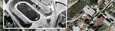
Nach der Hamburg-Touristentour für Google Earth gibt es jetzt ein kleines Sammelsurium: Eine Insel voller Kleingärtner, das höchste Bauwerk der Stadt, runde Dinger, die Ghaddafi gehören, und dergleichen mehr — als Placemark-Ordner für Google Earth zum Download. Diesmal habe ich die Überlagerungsfunktion ausprobiert: Die Flughafen-S-Bahn-Trasse und der unterirdische Hera-Speicherring werden als Grafik in das Satellitenbild eingeblendet.

Google Earth plus GeoURL

Geografische Koordinaten von Weblogs zu Satellitenkarten.

Wieder einmal nur für Google-Earth-Nutzer: Man nehme ein Weblog mit angegebenen geografischen Koordinaten, beispielsweise dieses hier. Man nehme Patrick H. Laukes Umwandler GeoURL to Google Earth und gebe die URL ein. Man erhalte via Google Earth ein Satellitenbild mit markierten Weblogs (und Webseiten) in der Umgebung. Der Umwandler bietet übrigens die Wahl, ob er die Daten einmalig erstellen oder stetig, im 12-Stunden-Rhythmus aktualisiert, abfragen soll.

Oder anders — man nehme die Koordinaten einer Stadt, beispielsweise Lissabon (38.715, -9.1364), gebe sie dem Umwandler und erhalte die Weblogs und Webseiten in der Nähe. Ein Tipp: Google Earth blendet Koordinaten in Dezimaldarstellung ein, wenn man im Menü „Tools“, Menüpunkt „Options“, Kartenreiter „View“ das Häkchen bei „Show lat/lon in degrees, minutes, seconds“ löscht.

(Leider funktioniert der Umwandler die Verwendung noch nicht völlig stabil, wie mir scheint — siehe Kommentare.)

Hamburg aus dem All

Kleine Touristentour in Google Earth.

Da Google Earth das Hamburger Stadtzentrum nun nicht mehr als Kartensuppe darstellt, gibt es zur Feier des Tages eine kleine Touristentour der Stadt als Tour-Placemark für das Programm. Einfach öffnen und auf den Play-Knopf drücken. (Zuvor im Tour-Programm: Ed Ruschas Parkplätze in Los Angeles.)

Nachtrag: Der Vollbild-Modus mit F11 ist allen bekannt, hoffe ich?

Ed Ruscha meets Google Earth

Parking lots from Space.

Ed Ruscha’s parking lot shots belong to my favourite photographies for quite some time now. These „simple patterns that remind me of where I am or where I’ve come from“ (Ruscha) were published in his 1967 book „Thirty-four Parking Lots in Los Angeles“. Taken from a helicopter on a Sunday morning, they show linear parking simplicity as well as elaborate parking systems around the Dodgers Stadium.

Ruscha locations today

Forty years later, quality L.A. aerial photography is available easily and for free — thank you, Internet. I have put together a tour of most of the locations with links to Ruscha pictures at Yancey Richardson Gallery. The medium of choice is of course Google Earth: Here is the Google Earth placemark folder for the Ruscha tour. Download and use the Play button for a virtual helicopter flight. Unfortunately, you need a broadband connection, Windows and a fast computer for Google Earth, so for all the others here a links to Google Maps pages and the corresponding pictures.

Pierce College, Woodland Hills (Ruscha #26)
Pierce College, Woodland Hills (Ruscha #27)
Canoga Park (Ruscha #12)
5500 Canoga, Woodland Hills (Ruscha #17)
7101 Sepulveda Blvd., Van Nuys (Ruscha #20)
7133 Kester Ave., Van Nuys (Ruscha #8)
Church of Christ, 14655 Sherman Way (Ruscha #21)
14601 Sherman Way, Van Nuys (Ruscha #19)
14425 Sherman Way, Van Nuys (Ruscha #6)
14400 Sherman Way, Van Nuys (Ruscha #14)
Federal, County & Police Building lots, Van Nuys (Ruscha #29)
6150 Laurel Canyon Blvd., North Hollywood (Ruscha #7)
Bellingham & Hamlin, North Hollywood (Ruscha #11)
6610 Laurel Canyon Blvd., North Hollywood (Ruscha #9)
2627 N. Hollywood Way, Burbank (Ruscha #2, #3)
Fashion Square, Sherman Oaks (Ruscha #24)
Universal Studios (Ruscha #18)
Hollywood Bowl (Ruscha #4)
Wilshire Blvd. & Santa Monica Blvd. (Ruscha #30)
Century City (Ruscha #22, #23)
6201 W. 3rd St. (Ruscha #16)
6067 Wilshire Blvd. (Ruscha #25)
5600-5700 Blocks of Wilshire Blvd. (Ruscha #28)
5000 W. Carling Way (Ruscha #5)
4465 Wilshire Blvd. (Ruscha #15)
5th & Hill (Ruscha #1)
Dodgers Stadium (Ruscha #13)

Google Maps plus Tags

Tagzania verschlagwortet Geodaten.

Tagzania (via Heiko Hebig) dient der Verschlagwortung von Geodaten. Oder anders: Ich kann Orte auf Karten markieren, mit Titel, Beschreibung und Schlagworten versehen — und diese Daten dann nach Schlagworten oder nach Benutzern abrufen.

AKW-Karte bei Tagzania

Und so kann ich relativ schnell eine Karte mit den Standorten deutscher Atomkraftwerke basteln. Heiko Hebig hat NORAD und das Hauptquartier von Six Apart markiert, Nico Lumma das Willy-Brandt-Haus und das Hauptquartier von blogg.de.